
Converse ZIP Code Coverage
The City of Converse ZIP map, dated June 20, 2024, explicitly names 78109. It places that postal area around FM 78, FM 1976, FM 1516, Toepperwein Road, Rocket Lane, SL 1604, and IH 10. The official source review did not find a complete city-overlap table for every ZIP that might touch the municipal line. This Converse ZIP code directory therefore treats 78109 as verified and preserves other suggested ZIPs as research gaps until a current official address or GIS check confirms them.
| Verified ZIP | Local map evidence | Postal location | Boundary note |
|---|---|---|---|
| 78109 | Named on the dated City of Converse map, with the local road context shown there. | Converse Post Office, 9155 Schaefer Rd, Converse, TX 78109-9998. | The yellow postal area and orange city-limit hatch differ on the map. |
Possible 78150 and 78244 overlaps appeared only as non-authoritative leads in the research. They are not stated here as Converse coverage. Check a live USPS address result and the current Bexar GIS before calling either a city ZIP. A ZIP code directory is most reliable when it says what is verified and what still needs confirmation.
Converse ZIP Boundary Puzzle
The City map provides the clearest local visual lesson. Orange hatching marks city limits, while yellow marks the 78109 postal area. The shapes do not match. A mailing-city label, ZIP code, city limit, county jurisdiction, and service district can each describe a different boundary. This is a location-specific quirk worth recording before a parcel, court, permit, or election search is attributed to Converse.
Use the map as a boundary aid, not a legal survey. It can help a researcher recognize why an address that looks local needs a second check in the city-limit or parcel layer. It cannot establish incorporation, occupancy, or a final jurisdiction by itself.
Note: Keep the map date beside any ZIP conclusion because postal and municipal geography can change on separate schedules.
Converse ZIP GIS Fields
The Bexar ZIP GIS layer supplies polygons and query operations rather than a prose list of city overlaps. Its reported fields include post-office name, state, square miles, ZIP, longitude, latitude, and geometry. The service explains that the first three ZIP digits identify a sectional center, while the fourth and fifth identify a post office, station, or local delivery area. It is useful for documenting a postal polygon, then comparing that polygon with the city map and parcel information.
The Bexar ZIP GIS service below is the source for the polygon and field structure.
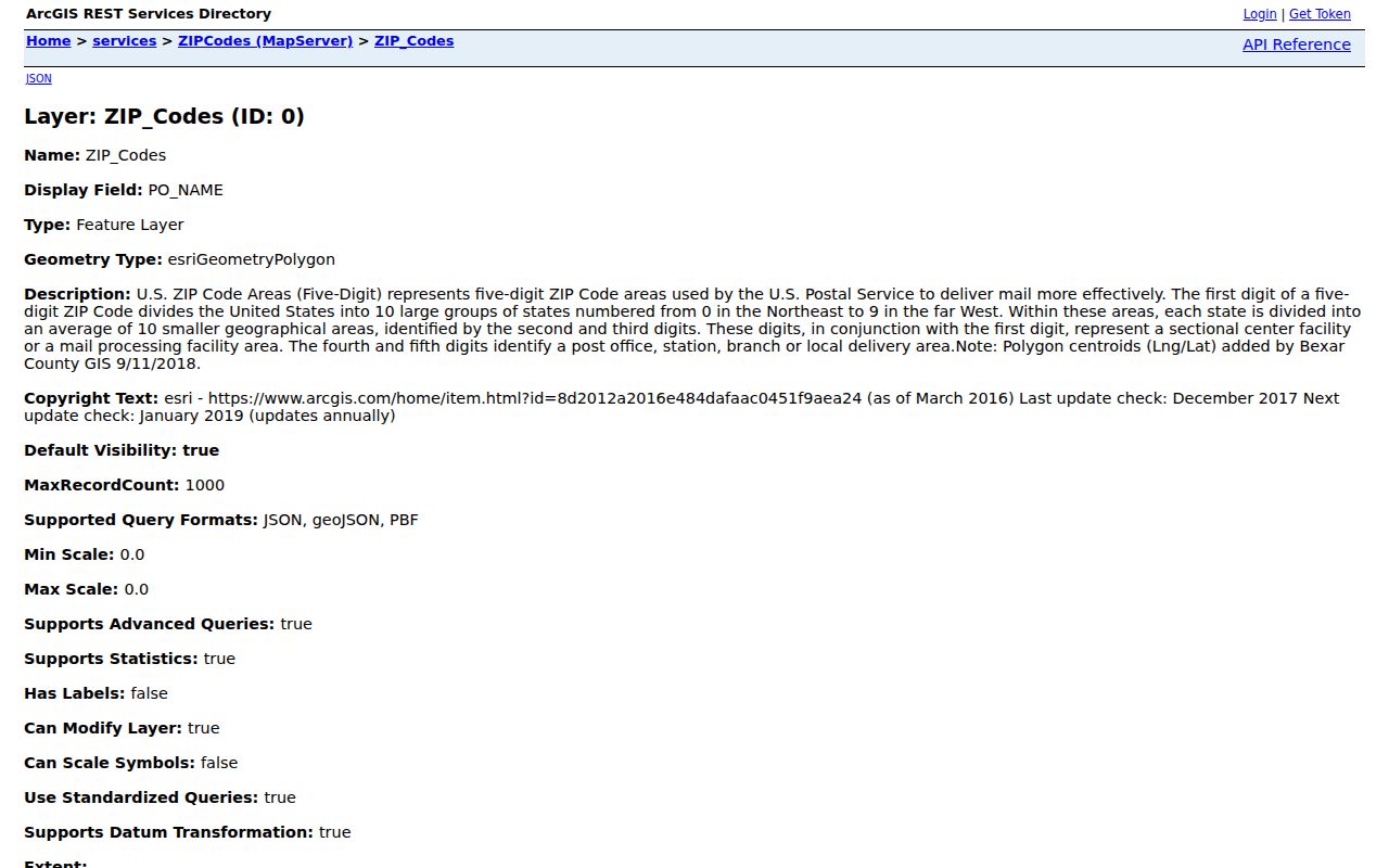
The layer notes a December 2017 update or check date and annual update practice. Cross-check it against current USPS addressing before relying on it for a newly changed or disputed delivery address.
Converse ZIP Code Address Checks
ZIP searching works best as an address-normalization task, not as a ZIP-wide roster. Bexar’s multi-role geocoder accepts single-line and component address information, including postal and postal-extension fields. Its result can retain the candidate match, city, postal values, and coordinates. BCAD search is mainly by property ID, name, or street address, while parcel results expose ZIPCode. A property result can locate a parcel, but it should not be used to label a person as a current occupant.
- Enter the full address in the county geocoder or parcel map and retain the normalized candidate.
- Compare the returned postal ZIP with the city-limit layer and the dated Converse map.
- Use BCAD or the parcel layer to record the property ID, legal description, formatted address, and ZIPCode field.
- When the question becomes street-specific, continue with the Converse street directory rather than treating the ZIP as a full address trail.
Keep four values apart: physical or situs address, owner mailing address, legal description, and postal ZIP/city. They can differ without making an official record wrong. A deed or plat may use block and lot information, while USPS uses delivery geography and BCAD retains separate mailing lines.
Converse ZIP Code Precinct Checks
The Bexar Precinct Finder accepts Street Name or ZIP Code and can return matching streets or address ranges, precinct, ballot or sample ballot, polling location, and representatives. If both inputs are present, street takes precedence. The tool is useful for a jurisdiction check after an address has been normalized. It is a current planning file, not a ZIP-wide voter list, and Bexar Elections remains the final contact for an election-cycle question.
| Precinct Finder input | Documented result or rule |
|---|---|
| Street Name | Street search takes precedence when a street and ZIP are both supplied. |
| ZIP Code | Returns matching street and address-range options within the tool. |
| Street selection | Choose the matching street, then narrow to an address range or block. |
| Range indicator | Results use even and odd address-range indicators. |
| Result links | Can include precinct, ballot, polling location, and representatives. |
For a street search, do not include a pre- or post-directional. The county’s instructions use “Main” rather than “S Main.” That small formatting rule can prevent a false no-match during a Converse ZIP code check.
Converse Post Office Details
The USPS Converse Post Office listing confirms 9155 Schaefer Rd, Converse, TX 78109-9998, phone 210-658-5129, weekday hours of 8:30 a.m. to 5 p.m., and Saturday hours of 8:30 a.m. to 12:30 p.m. The listing establishes a local postal-service point. It does not establish the boundary of every address using the ZIP or prove that an address lies inside city limits.
The official USPS location entry below provides the local postal details used in this Converse ZIP code directory.
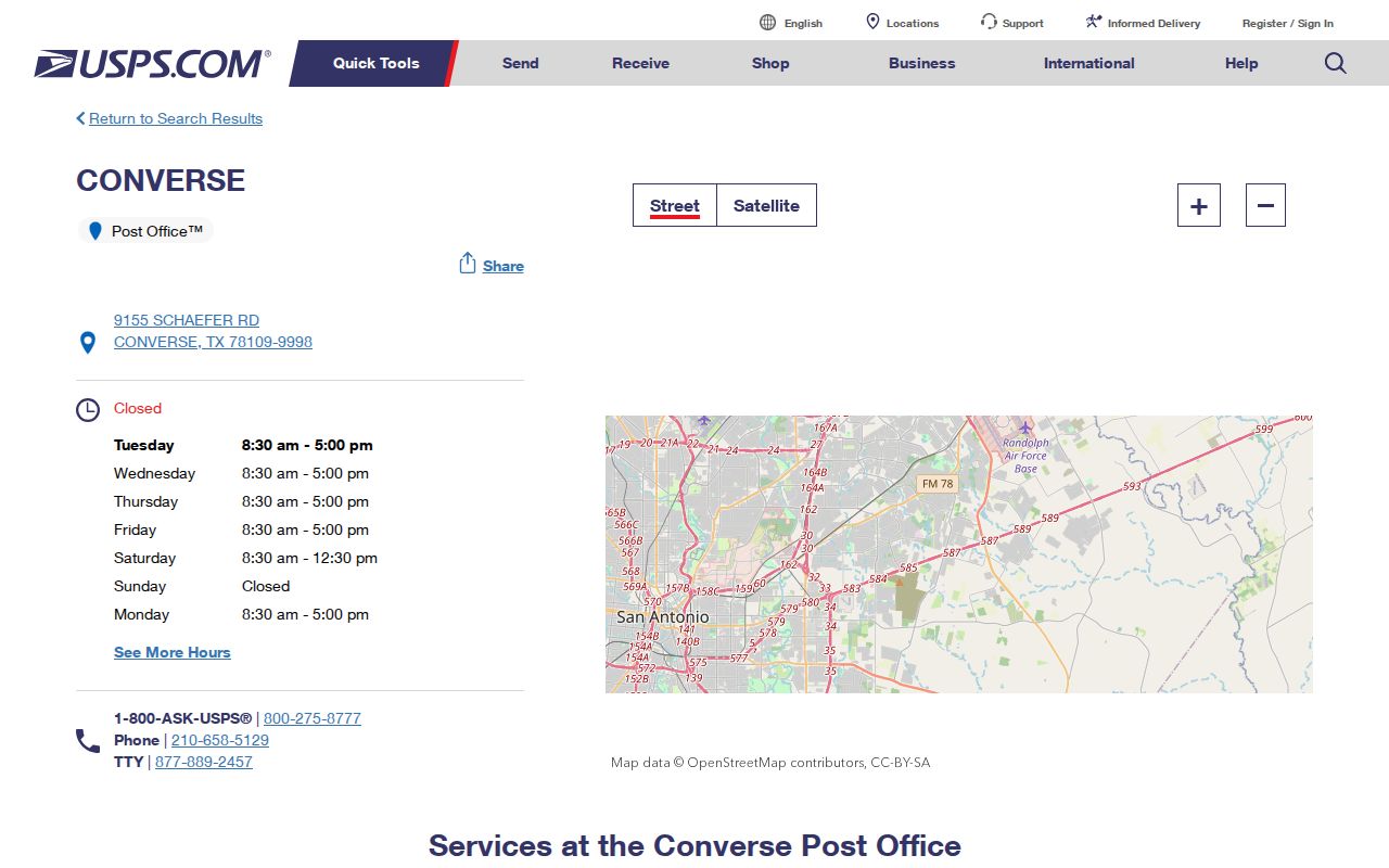
Use the location entry alongside the city map and GIS polygon. That three-source comparison separates post-office service from a municipal-boundary conclusion.
Converse Growth and Postal Scale
Converse has grown from 8,887 people in 1990 to 27,466 in 2020, with a 2025 estimate of 32,481 in the Census QuickFacts profile. Those totals describe the city, not the number of people in a ZIP. They are a reminder that a postal polygon and an incorporated city are different units even when both use the name Converse.
Population figures should never be used to fill an unverified ZIP-overlap gap. The city’s dated map, live USPS address information, and Bexar layers are the documented routes for a specific address question.
Converse ZIP Search Limits
No official ZIP split or realignment year specific to Converse was located. The City SmartGov public page advertises parcel search, but its exact ZIP filter did not render during research. The Bexar voter registration check uses date of birth, house number, and last name, not a ZIP-wide roster. A Texas statewide voter-file request can specify counties or districts, but it requires a form, affidavit, and use certification, so it is not a casual ZIP search.
The data windows also differ by custodian. BCAD says its website offers the current appraisal year and five prior appraisal years; older appraisal material can be requested under the Public Information Act, and material before 1983 is directed to Bexar County Tax Office archives. That is an appraisal-coverage statement, not a promise that an older deed, plat, or GIS shape can be found in the same place. The Bexar Official Records portal provides indexed land-record searching but does not publish a first online year. For earlier Bexar instruments, TSLAC microfilm is the documented historical route, with its own reel and filming gaps.
For an ambiguous new or renumbered address, Bexar’s addressing guidance identifies CPS Energy as an authorized addressing agent in its service area. A verification request can use the physical address, property ID, legal description, and county block, subdivision, block, or lot information. That process can resolve a physical-address question, but it does not make a CPS service address a city-limit decision. Compare the returned address with the city map, parcel layer, and postal result.
Postal filtering also stops at custodian lines. The County Clerk index is organized around recorded parties, document type, subdivision, document number, and date range, not a ZIP-wide address list. The voter registration check uses date of birth, house number, and last name, while the Precinct Finder works from a street or ZIP to a range and election context. Use the ZIP to narrow geography, then use the right source for the record relationship being checked.
For a documented gap, save the portal URL, input mode, address terms, source date, and result context. A no-result in a postal or parcel tool means only that the queried route did not return a match. It does not establish that an address is absent from Converse or that a person is absent from a location.
Converse ZIP Code City Limits
A ZIP code is postal delivery geography. It can be useful in a record search, but it is not the same thing as municipal incorporation. The official Converse map is clear on this point: the 78109 area extends differently from the city-limit hatch. Verify city jurisdiction with the relevant city or county layer, then record the source and date beside the ZIP finding.
- ZIP and ZIP+4
- A ZIP identifies a postal delivery area; ZIP+4 is an added postal extension used to narrow delivery sorting.
- PO box ZIP
- A ZIP used for post-office boxes rather than proof of a physical municipal location. No Converse PO-box-only ZIP was verified in the inspected sources.
- Unique ZIP
- A ZIP assigned to one institution or delivery arrangement. No Converse unique ZIP was verified in the inspected sources.
- Carrier route
- A delivery grouping used within postal operations; it is not a city-limit boundary or a resident list.