
Trace a Converse Street Directory
A street-by-street search works best when each source answers one narrow question. The city map and county address tools help normalize the location. BCAD then ties the site to a property ID and legal description. The County Clerk index can show a recorded land relationship, while precinct tools describe an address range rather than a public block roster. Historical directories may add a dated household lead. Keep the source date beside every result, because an appraisal owner, a recorded grantee, and a dated occupant entry are different relationships.
- Confirm the street spelling, number, unit, postal ZIP, and city-limit result. Preserve an alternate spelling or a rural-route form when one appears in an older source.
- Search the address in the BCAD map or by property ID. Record the parcel identifier, situs address, legal description, year built, and appraisal-owner label.
- Use parcel geometry and the Precinct Finder to check the matching street segment and address range. A precinct result is not a list of people on the block.
- Search the Bexar Official Records index with the owner name, legal description, subdivision, document type, or recorded-date range. Follow each earlier grantee or grantor only as the instrument identifies that role.
- For a dated household lead, check the regional directory and archive route using the exact address and name variants. Note the volume, year, page, and geographic coverage before treating a listing as Converse.
That sequence is an address-record trail, not a current occupancy list. It also leaves a clear point to stop when the public record does.
Normalize a Converse Address Search
Begin by separating postal geography from government boundaries. The City of Converse 78109 map uses different colors for the city-limit area and the postal area. A Converse mailing address is not, by itself, proof that the parcel sits inside the incorporated city. The Bexar geocoder can help compare a normalized candidate, postal field, and coordinate, while the parcel layer supplies property-specific address fields.
For precinct work, the Bexar Precinct Finder asks for a street name or ZIP, then narrows the result with the matching address range. Its instructions say to search a street without directional prefixes. Record the candidate selected and the access date. Do not replace a legal description with a map label, and do not assume the address range is a record of present occupants.
Converse has no located official citywide street-renumbering or renaming year. City minutes, recorded plats, address-verification material, and dated maps are the proper places to investigate a specific change. The city brush-zone list can help with a subdivision spelling, but it is an operational service list, not a legal neighborhood boundary or a resident source.
Note: Preserve the original street form alongside the normalized result when an older record or map uses a different name or routing reference.
Read Converse Parcel Fields
The BCAD interactive map is the main appraisal and parcel starting point for a Converse address search. It can search a property ID or all or part of a name or street address. Neighborhood, subdivision, Mapsco, and radius controls can narrow a map view, and the results grid has an export control. The site limits results to 1,000 rows. BCAD provides the current year and five prior appraisal years online according to its request form; it does not publish a first online year on the map page.
The screenshot below shows the public BCAD map controls used to begin a Converse parcel search.
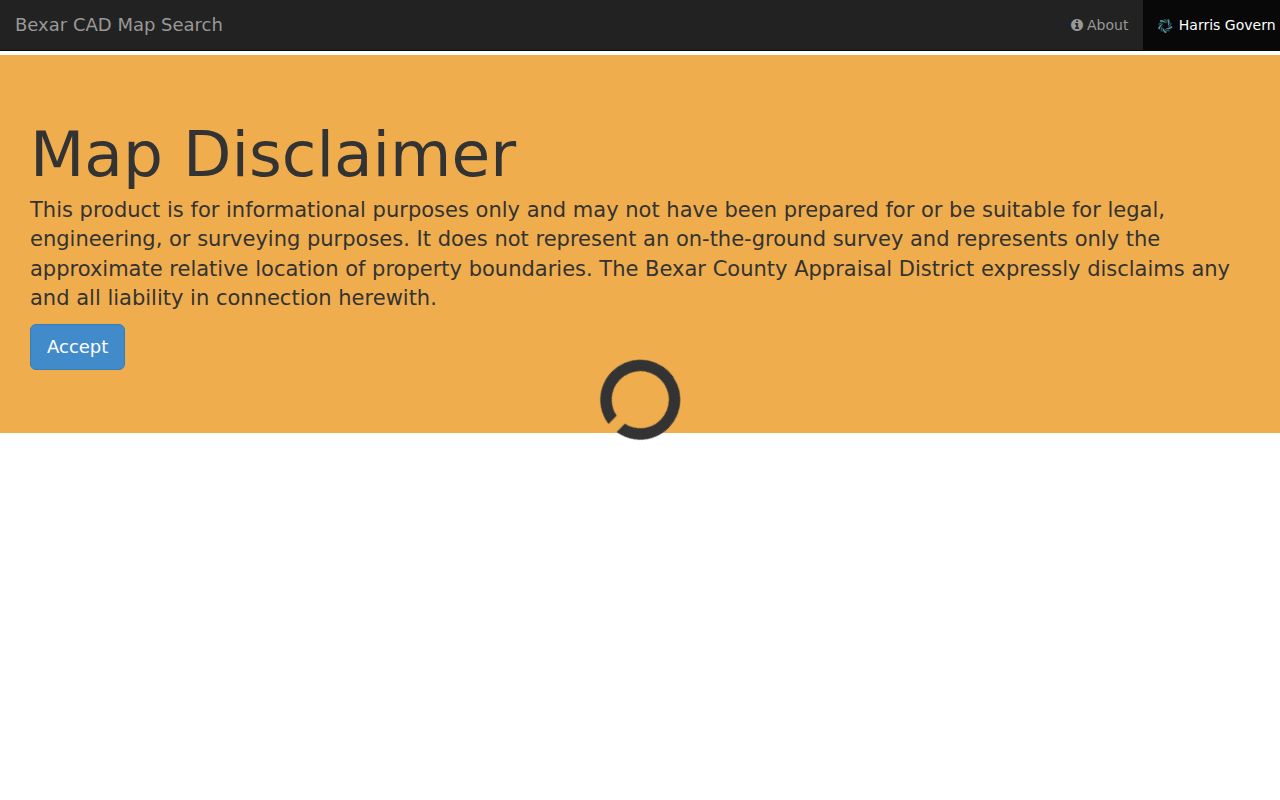
A returned parcel supports an appraisal relationship and an address-keyed property lead. It does not settle title, survey a boundary, or establish who currently occupies the property.
| BCAD control | How to use it | Important limit |
|---|---|---|
| Property ID | Enter the positive integer property identifier. | Limited to 10 digits in the captured control. |
| Name or street address | Use all or part of a name or street address. | It is a search lead, not proof of occupancy. |
| Neighborhood or subdivision | Select the local area, then run the search. | Check names against the parcel legal description. |
| Radius and map tools | Browse a street segment or measure a map view. | Verify a boundary with a recorded plat. |
| Analyze and export | Choose an area, find properties, then export results. | The displayed result set is capped at 1,000 rows. |
Define a Converse Address Record
A parcel record carries several address concepts that can look alike but mean different things. The county open parcel layer includes property ID, address key, legal description, house number, directional and street fields, unit, ZIP, formatted address, year built, owner fields, mailing lines, and approximate geometry. Those fields make it possible to compare sources without calling each name a resident.
- Parcel
- A defined piece of property represented in appraisal and GIS data. The county describes displayed boundaries as approximate, not a legal survey.
- Situs address
- The physical location assigned to the parcel. It can differ from the owner's mailing address.
- Plat
- A recorded map that can identify a subdivision, block, lot, easements, and dedications. It is stronger than a map label when lot adjacency matters.
- Criss-cross directory
- A historical directory arranged from an address or street to a listed name, rather than from a surname to an address.
When the mailing line differs from the situs address, preserve both labels and the source date. A mailing address can be elsewhere, and a person receiving mail at an address may have no recorded property role there.
Follow a Converse Deed Chain
The Bexar Official Records portal is the recorded-instrument route. Its captured controls include a search term, recorded-date range, quick date ranges, Index Only or Index & Full Text (OCR), Quick Search, Advanced Search, and department switching. Use grantor or grantee names, subdivision, document type, document number, and the legal description from the parcel record. Write down the recording date and instrument number before moving to the next link in the chain.
The image below is a view of the Bexar deed-index search interface, where date, party, subdivision, and document searches lead to recorded land instruments.
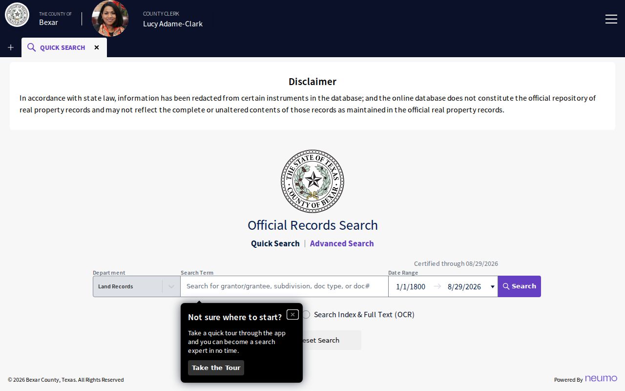
Online discovery and certified copies are separate paths. The index is free to search and can support uncertified printing, but a certified copy follows the County Clerk's process. The clerk identifies Recordings at 101 W Nueva, Suite 103, and says original documents may be presented in person or mailed. The portal does not state its first online coverage year, so an empty online result is not proof that no older instrument exists.
Note: A deed can name a trust, estate, lender, entity, or several parties, so the recorded role and date should remain visible in every street result.
Use Converse Permit Leads
Converse SmartGov adds city-created address material to the street trail. Its public home advertises parcel search, permits, drawings and documents, inspections, pending and issued permits, inspection results, account access, and concern reporting. The exact public permit-search fields and earliest published permit year did not render in the inspected source. That gap matters: do not claim that a field, document image, or date range is available until the live portal shows it.
This Converse SmartGov public portal image shows the permit and parcel entry point for an address-based record search.
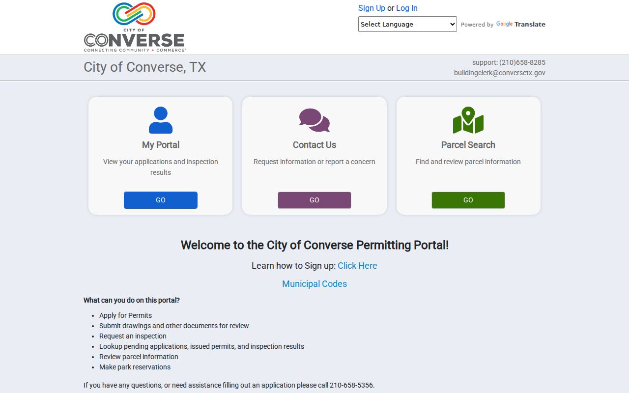
A permit can document a city record connected to a parcel, not a current resident. If an older or more specific record is missing online, the City Secretary's public-information form is the fallback. A narrow request should give the address, parcel or property ID when known, date span, record type, desired releasable fields, and digital format. The form allows digital delivery, paper copies, or inspection and describes estimates above $40 and possible prepayment, bond, or deposit above $100.
Check Older Converse Street Evidence
Historical address work needs a different standard. The Texas State Library and Archives Commission explains that directories may include a name, address, telephone, spouse, occupation, and an ownership or occupancy notation. Its documented San Antonio directory runs extend from 1879–80 through 1993, but no dedicated Converse run was located. Inspect a volume's geographic coverage before treating a street hit as local. Search a road variant, rural-route reference, nearby railroad context, subdivision, and county precinct when the modern city name does not appear.
For the directory collections themselves, use the Converse city directory resources. On a street search, the useful capture is narrower: title, year, page, printed address, nearby names, and the scanned image URL. A dated listing can support a historical address trail. It cannot establish a person's present location.
The same restraint applies to census, newspaper, church, cemetery, probate, and naturalization leads. They can explain an older household or property connection only when their date and geographic reference are recorded.
Converse Records Before Modern Boundaries
Converse grew from an 1877 townsite purchase and an 1878 post office, while Bexar land and court records reach much further back. Older material may use county, railroad, rural-route, subdivision, or San Antonio-area references instead of the modern municipal name. That history is a reason to search the property description and record series, not just a street spelling.
The TSLAC Bexar County guide documents deed records from 1837 through 1889 on microfilm. Its direct and reverse name indexes are on separate reels. It also warns that deeds-of-trust volumes 17, 18, 24, 30, 36, and 41 were not filmed and that there is no volume Q. A missing image may therefore be a filming gap, not proof that an earlier transfer never happened.
This is the long-record story behind a careful Converse address inquiry. The document date, reel or volume, page, image, and legal description are more durable than a present-day street label.
Compare Converse Street Directory Records
Address-keyed sources overlap, but they are not interchangeable. Start with the record that matches the question, then compare only the public fields and dates needed to resolve a conflict. BCAD handles appraisal information, the County Clerk holds recorded land instruments, the Tax Assessor-Collector handles billing and collection, and city departments keep their own records. This coverage view keeps a street search from turning different relationships into one unsupported claim.
| Address record | Address key | What it can show | Access and coverage |
|---|---|---|---|
| BCAD appraisal | Property ID, situs, owner or mailing address | Parcel, legal description, owner label, year built, ZIP, appraisal characteristics | Current plus five prior appraisal years online; older material by public-information request. |
| County deed or plat | Party, legal description, subdivision, instrument | Transfer, plat, lien, trust, release, or another recorded relationship | Free online index; first online year not published; older Bexar series begins in 1837. |
| Bexar parcel GIS | Parcel geometry, address, property ID, ZIP | Coordinates and owner, legal, address, and year-built attributes | Approximate geometry with query and export limits. |
| Precinct Finder | Street and address range | Precinct, ballot, polling, and representative information | Current-cycle planning file, not an open block roster. |
| City permit record | Parcel, address, permit | Permit description, status, inspection, and releasable fields | SmartGov advertises current services; exact public fields and dates remain unconfirmed. |
| Historical directory | Street or address text | Dated name, address, phone, spouse, and occupancy notation | San Antonio runs are documented; no Converse-specific run was located. |
| HOA certificate | Association, city, county, ZIP | Subdivision association and certificate relationship | State database with a completeness and reliability disclaimer; not a member roster. |
Note: When two sources disagree, compare their record dates and relationship labels before deciding whether they describe the same parcel or event.
Keep Converse Address Boundaries Separate
A property can have a situs address, an owner mailing line, a legal description, a postal ZIP, a city-limit result, and a precinct assignment. These values may differ without any source being wrong. The city map names 78109 and shows that its postal area and city limits do not match exactly. The Bexar ZIP layer and parcel service can add geographic context, but neither changes the legal description in a deed or plat.
When a street result is ambiguous, retain the normalized candidate, coordinate, source layer, and access date. The Bexar GIS description says parcel boundaries are approximate and not legal, survey, or engineering data. A recorded plat is the better source when exact lot adjacency is important. The public voter lookup does not supply an open street roster, and confidential addresses may be suppressed.
When a legal description identifies a subdivision, the Texas HOA certificate search can identify an association and certificate relationship. Its database disclaims guaranteed completeness, reliability, and validity. It is not a member roster or a way to identify occupants.
Limits of a Converse Street Directory
Public address records have clear boundaries. Appraisal data may show an owner of record but not an occupant. A recorded grantee may be a trustee, lender, executor, or entity. A permit applicant may be a contractor. The public voter tools protect confidential addresses, and utilities, delivery records, motor-vehicle address data, and household-member lists are not part of this public street workflow. Court or citation material should never be repurposed as an address claim.
Lawful use. Use Converse street records for personal, lawful research such as family or property history. Do not assemble public fields to stalk, harass, intimidate, or harm anyone.
Texas Government Code Chapter 552 allows written requests for existing public information, subject to exceptions and redactions. Request only the defined record class that is missing, identify the address and date span, and ask the appropriate custodian for releasable material. A public result remains a dated source record, not an invitation to publish sensitive details.
Note: A careful address capture preserves the source URL, date, record role, and any correction route instead of labeling every name on a street as a resident.