
Converse Neighbors and Block Records
Public sources can outline the physical and civic setting around a Converse address, but each has a narrow role. The county parcel layer can show adjacent parcels and attributes. A recorded plat can identify a subdivision and phase. Precinct tools describe a current election geography. An association certificate identifies an organization, not its members. Keep an owner, a mailing field, a voter precinct, and an association name separate rather than treating them as a roster of neighbors.
| Block source | What it can show | Access boundary |
|---|---|---|
| Bexar parcel layer | Parcel geometry, address, owner fields, legal description, ZIP, and year built. | Free GIS query; boundaries are approximate, not a legal survey. |
| BCAD map | Property ID, appraisal-owner fields, neighborhood, subdivision, and radius tools. | Results cap at 1,000 rows; appraisal owner is not proof of occupancy. |
| Precinct Finder | Street range, precinct, ballot, polling location, and representatives. | Current planning file; no public block roster. |
| Texas HOA certificates | Association, certificate, management or contact relationship, and filing context. | Submitted-data completeness disclaimer; no member roster. |
| Recorded plat and deed | Subdivision, unit or phase, block, lot, easements, and dedication. | Use the County Clerk index and preserve each party’s recorded role. |
A recorded grantee or appraisal owner may be a person, trust, estate, lender, or entity. A separate mailing address can be outside the parcel. These distinctions matter when researching Converse neighbors around one block.
Defining Converse Neighbors
“Neighbor” has several valid public-record meanings in Converse. It can mean the next parcel, a lot in the same subdivision or phase, an address in the same precinct, a point in the same ZIP polygon, or an association tied to the same development. Those categories overlap sometimes, but they are not interchangeable. Parcel geometry is the best start for adjacency. A recorded plat is stronger when the exact lot boundary matters. A ZIP or precinct result is a broader geography, not proof that two addresses share a block.
| Official record approach | Commercial neighbor-list category |
|---|---|
| Shows a dated source relationship such as parcel, owner field, plat, or precinct. | May combine mixed sources into a broad association that needs independent verification. |
| Provides a custodian, source date, and a defined correction route. | May not make the source, date, or relationship clear. |
| Leaves protected or unavailable fields protected. | A complete-looking list can still be stale, partial, or wrongly matched. |
Use an official parcel or plat for the physical block. Use an association certificate only to identify the organization linked to a subdivision. A person-to-person neighbor list is not a defensible result from these mixed sources.
Mapping Converse Neighbors
The practical block method starts with one normalized street address. Open the county parcel layer or BCAD map, identify the target parcel, then click the surrounding parcel polygons. Record property IDs and legal descriptions along with the source date. The parcel layer is approximate, so a recorded plat is the next check when lot adjacency is important. The method maps a physical block without making unsupported claims about every household around it.
- Locate the address in the Bexar map or geocoder and confirm the formatted address.
- Click the target parcel, then the immediately adjoining parcel polygons, recording each property ID and legal description.
- Compare a parcel’s owner field and mailing lines with the appraisal record, retaining the label and date.
- Use the County Clerk index for the recorded plat or deed when the subdivision, phase, or lot relationship matters.
- For a full named-street record chain, use the Converse street directory.
The official Bexar parcel-layer screen below documents the fields and approximate-boundary warning used in this block workflow.
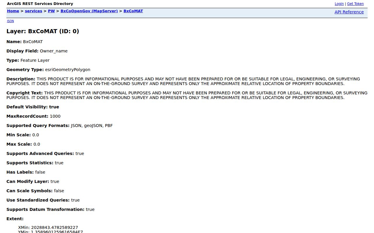
Map edges and lot shapes are not engineering or survey evidence. A source result should name the parcel field used, the access date, and the fact it supports.
Converse Neighbor Parcel Fields
The BxCoOpenGov parcel schema makes clear why labels matter. It can expose a property ID, address key, legal description, house number, street components, unit, ZIPCode, formatted address, year built, owner ID, owner name, mailing lines, coordinates, and geometry. No personal parcel was selected during the research inspection. These are schema-level fields, not permission to build a profile of a block.
- PropID and AddrKey: county identifiers for the parcel and address record.
- Legal_desc: the parcel’s recorded-style legal description.
- Address and ZIPCode: formatted location and postal fields that should be checked separately from mailing lines.
- Owner_name: an owner field, not a declaration of present occupancy.
- Yr_blt: a year-built attribute that describes a structure record, not a person.
- Longitude, Latitude, and Shape: mapping attributes subject to the county’s approximate-boundary disclaimer.
The BCAD map also offers neighborhood, subdivision, radius, and Analyze Map Data controls. Its 1,000-result cap matters when a broad area is selected. Keep the search small and tied to a documented block question.
Converse Neighbor Association Leads
The Texas HOA management-certificate search is the official association-name route identified for Converse. It allows association name, county, city, ZIP Code, and association-type searches, with certificate PDF links. Its own disclaimer says submitted data is not guaranteed complete, reliable, or valid. A certificate can identify an association and management or contact relationship. It is an organization map, not a resident or member roster.
Bridgehaven Homeowners Association Inc.
Observed as a Converse or Bexar certificate-search row. Confirm the certificate’s city, ZIP, and filing details before linking it to a specific parcel.
Horizon Pointe HOA
Observed as a certificate-search lead. A phase name can vary, so compare it with a recorded plat and legal description.
Meadows of Copperfield HOA
Observed in the official search inventory. It identifies an association lead only, not the people who live in the development.
Converse Rolling Creek HOA
Observed in the state certificate results. Check the exact certificate name, type, filing date, and associated plat.
The research also observed Prairie Green, Vista Real Converse, Punta Verde, Fairway Crossing, Avenida, Windfield, Catalina, and other association names. The City of Converse did not expose a central association hub or membership directory. For a missing association, compare the certificate search with a recorded plat or deed rather than guessing from a neighborhood name.
Converse Neighbor Precinct Checks
The Bexar Precinct Finder can show whether an address lies in a current precinct and which street range contains it. Search without a directional prefix, select the matching street, then narrow to the even or odd address range or block. The result may include precinct, ballot or sample ballot, polling location, and representatives. It is helpful for a civic-boundary question, but it does not identify people living nearby.
Bexar’s voter registration check is more limited than a block search. Its visible inputs are date of birth, house number, and voter last name; a successful result may show a registered address and precinct. Confidential and suppressed addresses may be absent. Texas Election Code Chapter 18 also protects confidential addresses and restricts statewide voter-file use. Preserve the privacy boundary instead of looking for a workaround.
Note: Precinct, ballot, and polling relationships can change by election cycle, so retain the access date with a result.
Converse Neighbor Community Layers
The Bexar Community GIS dashboard accepts an address search or map click and can return local, county, state, and federal representation or community information. It draws from Bexar Elections, cities and counties, FEMA, and other public datasets. The dashboard carries an approximate-data disclaimer, so it should be used as a jurisdictional cross-check rather than as a property-boundary source.
The City ZIP map and Bexar ZIP layer add postal context. A same-ZIP result can span city-limit differences, while a same-subdivision result may cross a precinct line. Keep the source type visible when describing a Converse block.
Converse Growth and Blocks
Converse grew from 8,887 people in 1990 to 27,466 in 2020, and the Census QuickFacts profile gives a 2025 estimate of 32,481. Those citywide figures do not identify neighbors or establish a parcel boundary. They do show why older maps, historical directory entries, and current GIS layers may represent different stages in local development.
For a historic block question, retain the map or directory year, the street spelling, the record title, and the source image. The modern Converse name should not be substituted into an older record without noting what the original source actually says.
Converse Neighbor Privacy Limits
Texas law and custodian rules keep important information private. Voter systems protect confidential addresses. The Texas Address Confidentiality Program provides substitute addresses for eligible participants, and a substitute address must not be reverse-engineered into a physical location. Court systems withhold secured categories. Utilities, delivery records, motor-vehicle address records, private contact information, and household lists are not public block-research sources. An absent address may be the intended result of a protection rule.
Lawful use. Use Converse neighbor records for personal block awareness, civic context, family or property history, and documented corrections. Texas Penal Code §§42.07 and 42.072 address harassment and stalking; do not use source material to target, watch, or intimidate another person.
For a correction, retain the source URL, field label, record date, and relevant custodian. Ask for a correction from the office that maintains the record. Do not assemble protected addresses or sensitive fields into a list merely because other parts of a record are public.